These are the chronicles of Mike and Matt, father and son, cycling the Great Allegheny Passage as it meanders 150 miles from Pittsburgh, Pennsylvania to Cumberland, Maryland. Along the way, Matt and I pass over 20-30 bridges and through several tunnels, most of the time on a packed crushed limestone trail. From Pittsburgh to the Eastern Continental Divide, the GAP climbs 1,664 feet over 126 miles; from there to Cumberland, the trail drops 1,754 feet in 24 miles. Since much of the trail is on an abandoned railroad bed – abandoned in 1953, according to Tobacco Tim – the steepest grade is only around 1.75%. (More on Tim later. As soon as you get off the trail, though, the climbing gets serious – as we discovered.) This You-Tube video – 150 Miles in 150 Seconds – describes the trail better than my words can: https://m.youtube.com/watch?v=MhTim6dbksYQiw
We rode road bikes, me with a B.O.B. Trailer, Matt with rear wheel panniers, and the going was rough in places where the rain clumped the limestone. Mountain bikes or even hybrids would have been a better choice, but happily I had only one near fall, and Matt’s knee soreness was probably the result of inadequate training runs leading up to our trip. This long winter limited my training miles to 163, just one mile more than the 162 we would bike over the three days 5/15/15 to 5/17/15.
My one really close call actually came on the drive from Connecticut down to Matt’s house in Baltimore, when I listened to Google Maps and tried to cross over two lanes of traffic to get to the entrance of the lower level of the GWB. Without Google Maps’ prompting, I would never have attempted the maneuver – certainly not had Janet been with me. Even more impressive was the truck ahead of me and one lane to my left who followed me three lanes to the right. All to avoid a bit of traffic on the GWB’s upper level. Thanks Google.
Under Way: Falling Behind
Despite our preparations, everything seemed to take us longer than planned; from selecting Croakies to buying and later installing panniers, we were a little slow on the uptake, with the result that our visit to the Frank Lloyd Wright house Falling Water will have to wait for another time, maybe as we bike through Ohiopyle on Saturday. (Spoiler: Maybe not.)
The logistics of this trip were not trivial. We first drove a couple of hours to Cumberland, where Matt rented a U-Haul truck, into which we transferred all our gear. We left my Subaru out front of the train depot in downtown Cumberland; then we drove 150 or so miles to Pittsburgh over back roads to avoid the construction-related traffic on MD 68 West. It was a quite picturesque way to go, but we lost cell phone coverage a few times and ended up going several miles out of our way. The last tour at Falling Water was at 3:30; it was more like 4:30 when we passed nearby. From the perspective of safety, I don’t know which was worse, the narrow hills northwest of Cumberland or the narrow lanes of the Pennsylvania Turnpike leading to Pittsburgh (they have their nerve charging a toll for that road).
Pittsburgh: City of Bridges

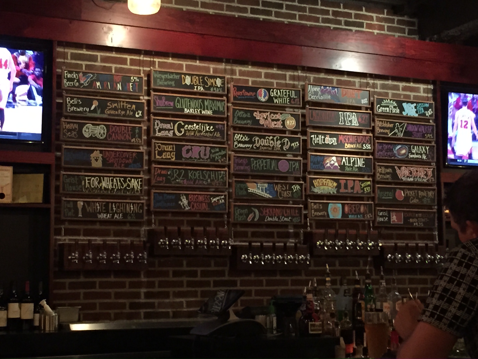
The confluence of the Allegheny, the Monongahela and the Ohio Rivers makes Pittsburgh a busy port, the second busiest inland port in the U.S., according to the Army Corps of Engineers. Of necessity, there are bridges everywhere. After finding the downtown Doubletree hotel and unloading our gear, we drove over the 10th Street Bridge to drop off the U-Haul, walked back over the 10th St. and did some reconnoitering at the Duquesne University campus, climbing the hundreds of wooden stairs that lead up from the Monongahela River. I’d guess that students are in great shape by the time they leave the Dukes’ hilltop campus. Later we made our way to the Proper Brick Oven & Tap Room for Pizza on Seventh Street and a wall full of brews to choose from.

PGH: Bike to Work Day and the Golden Ticket
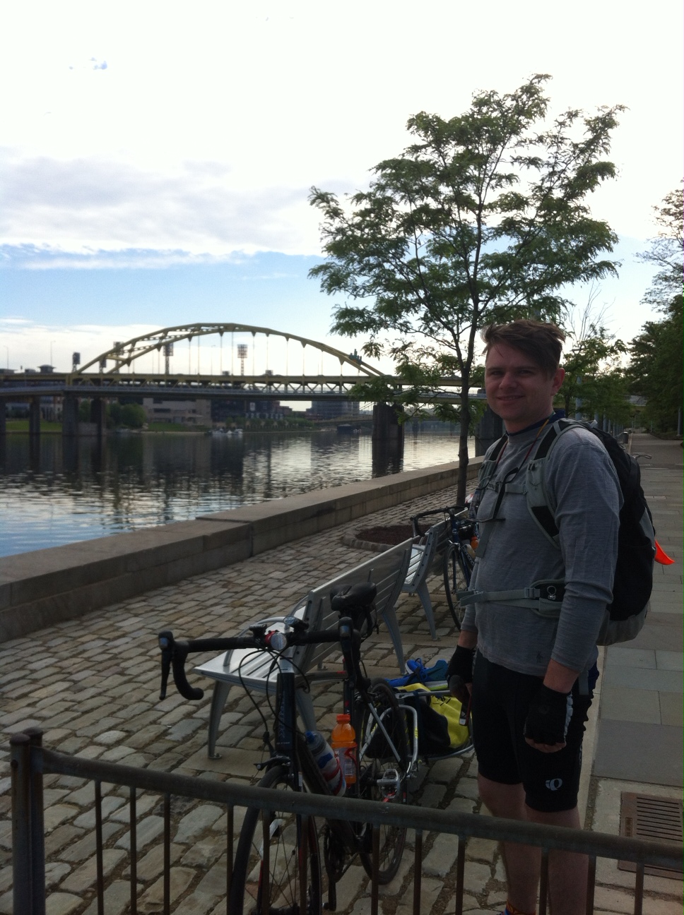
We chose the Doubletree for its location near the start point of our trip, Point State Park’s Confluence of the Three Rivers. By luck, Friday was Bike To Work Day, and BikePGH had a food and swag bag station downtown, where we ate some fruit and banana bread and Matt got a goody bag containing, we learned later, the Golden Ticket. (Matt contacted BikePGH after our ride, and they were happy that someone found the GT and sent some cycle wear – shorts, shirt and sunglasses – to Matt in Baltimore.)
Point State Park was just minutes away. We rode down to the confluence of the three rivers that define Pittsburgh. With some assistance from a friendly park ranger on a bike, we got under way, quickly getting off the streets of Pittsburgh, onto the GAP trail and across the Hot Metal Bridge, the first of many bridge crossings.
The early part of the ride was along the Monongahela River, beside railroad tracks, past lots of rail cars, many loaded with coal. On the river, Matt noted that we were just keeping pace with a barge of coal being pushed by a tug, not the most auspicious start. But the early miles were for the most part flat and on pavement. Before long we passed through McKeesport, one of the more run-down sections of trail we would pass. One couldn’t tell whether many of the factories and warehouses – at least those along the GAP – were still operating. Somewhere beyond here the path became packed limestone with occasional patches of sweet pavement, usually leading into and out of the towns on the GAP. It was also around this point that the GAP left the Monongahela and started following the Youghiogheny River (the Yock).
The first town we came to that was fully committed to bikes was West Newton, with a nice bike shop, B&Bs and restaurant less than 1,000 feet off the trail. We probably should have spent our first night in pleasant West Newton instead of pushing on for another 5 miles on the GAP and then another 5 miles off the trail (much of it uphill) to the Hampton Inn of Belle Vernon. (At least that was the plan.)
Belle Vernon, PA: More like Mount Vernon
Over the past century, the population of Belle Vernon has fallen by over 50%. The town has a 36-hole golf course, which advertises a $25 “flat rate.” Like everything else in Belle Vernon, the golf course is quite hilly. We rode up two steep hills to and then alongside the Cedarbrook Golf Course for a mile or so. Discouraged by the hills and the busy roads we encountered, Matt manned his i-Phone, found a vacancy at the nearby Comfort Inn and cancelled our reservation at the Hampton Inn. (Don’t know how I missed the Comfort Inn when I first made reservations.)
At the intersection of PA 981 and PA 51, we had the culinary choice of the GetGo convenience market and Spa 51, whatever that was. (Maybe that was why I had initially selected the more distant Hampton Inn?) We decided the golf course restaurant was our best bet for dinner, so we walked the one mile to the clubhouse. The food was good, although once again there was no tuna salad on the menu – just as on the prior day at the sandwich shop on our drive to Cumberland. (What kind of sandwich shop doesn’t have tuna salad.) With the sun setting around 8:15, we walked back along the cart path rather than on the road, narrowly missing a drenching when the sprinklers went on. In the pond on the course, we swore we saw a beaver or an otter, but it was possibly a fish.
As I spent a fitful night at the Comfort Inn in Belle Vernon, the following came to me as in a dream…
Bike-u
Avoid Belle Vernon
She may well be Belle, but she is
More like Mount Vernon
Ohiopyle: Fallingwater and Fallingtree
In the morning we beat a quick retreat from Belle Vernon and back onto the Great Allegheny Passage. Our objective was to make it to Ohiopyle for lunch, after which we would have just a little more than 10 miles to the Parker House, our bed and breakfast, sans breakfast, for Saturday night.
There aren’t many highlights on the GAP between West Newton and Ohiopyle. Connellsville may be an exception, but we’ll never know; I had read one blog that panned it, and we were rolling along at a good clip at this point. There also appeared to be a road race going on as we passed through. So we pressed on.
In Whitsett, as we ate the prior night’s leftovers at a trail-side picnic table, we did meet Tobacco Tim, a local man who came over to offer us water. Tim’s eyes lit up when we said we were from Connecticut; he told us that one summer decades ago his folks sent him up to work the tobacco fields outside of Hartford as a 14-year-old. Hence the moniker. (Tobacco Tom was already taken.)
A light rain was falling as we rode along, when we came upon a good sized branch blocking the trail. As I started to pass underneath the branch, I heard it cracking. Matt said, “Back up…fast.” I lived to tell the story.
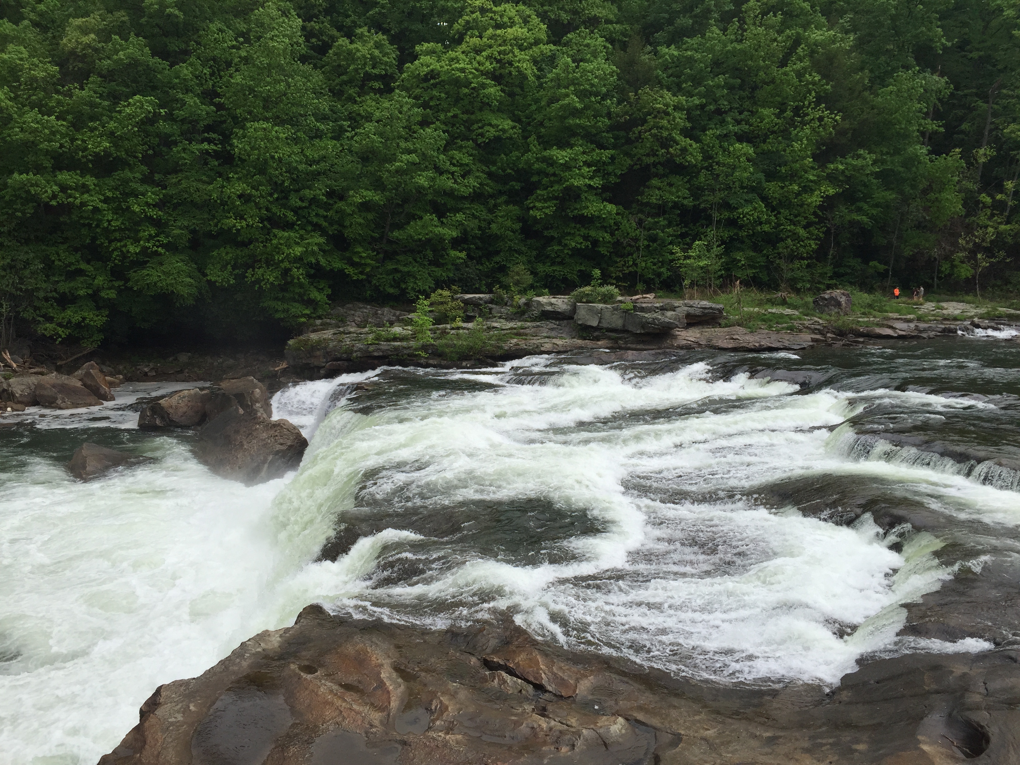
Ohiopyle had a lot to offer, including live music, but it was raining off and on when we got there, so we found a BBQ restaurant where we got out of the rain. With the bulk of Saturday’s miles behind us, Matt and I took our time eating and, when the rain let up, we took in the views along the river. The whitewater rapids are the town’s big attraction, and they are quite a sight, with one stretch easily a grade 4 or grade 5 run, in this layman’s opinion. We decided not to venture over to see Frank Lloyd Wright’s Fallingwater, figuring the extra 10 miles (5+5) and over 1,000 feet of elevation climb were a bit much at this point. As we walked our bikes over to see the whitewater, I managed to lose B.O.B.’s back wheel on a curb. Glad we weren’t tooling along the road when the wheel detached. I made sure to fasten it extra tight.

Soon enough, we were back on the trail for the final 12 miles of that day’s ride. The sky cleared as we got to our destination, the Parker House in Confluence. After innkeeper Mary gave us a tour of the house, we hosed off the caked-on mud from our bikes, B.O.B and the Panniers, and ourselves.
Confluence, PA: Where Three Rivers Meet (Just Not Those Three)
With time to spare before our 6:30 dinner reservation at the River’s Edge Cafe, we walked around Confluence, twice crossing two of the three rivers that meet here – the Youghiogheny and the Casselman – and never quite getting to the third – Laurel Hill Creek. There was a nice campground sitting below the Yough Lake dam; Matt wanted to hike up the side of the dam to see the lake, but my legs and my stomach demurred.
The town’s website shows that most of the shops, B&Bs and other establishments offer WiFi, but we had trouble with the Parker House connection. And there was no AT&T service on our phones. Luckily, as we passed Sisters’ Cafe, we were able to piggyback on their WiFi connection and sent some quick emails. The Cafe was closed by then, but we were able to stop early the next morning for breakfast with the Sisters in recompense.
Our dinner at River’s Edge Cafe was nice – Matt had trout, I ordered salmon – and at our table outside perched above a garden, we could watch the clouds/fog float by on the Casselman River. The couple at the table next to ours were celebrating their 40th anniversary, I think it was. Can I look that old? For desert we each ate a candy bar that we picked up earlier at the Hartman Service Center (where they were having a special on live bait).
Cumberland, MD: Where the GAP Meets the C&O Towpath
We were aiming to get an early, 6:00 or so start on Sunday morning, but it was more like 7:00 when we left Sisters’ Cafe. We had not even gotten out of town when the rain started, a steady rain that would accompany us for the next 10-15 miles. We still had 25-30 miles of climbing to go before we came to the Eastern Continental Divide, after which the final 20 miles would be a breeze – descending into Frostburg and then Cumberland, MD.
By the time we got to Rockwood (PA), the rain was letting up. Rockwood had a manned information booth where the GAP entered the town. Matt and I signed Rockwood’s guest log; I counted only about 25 names so far in 2015 (@May 15). This was a bit surprising, considering that there had been a big story about the GAP in the Sunday Travel section of the New York Times just weeks earlier. Rockwood might have been worth a longer visit, but there were thunderclouds near, so we pushed on towards Meyersdale. There we found a railroad museum, but the sky was darkening again. Meyersdale was that rare town on the GAP where most of the town’s amenities were located downhill from the trail. But downhill can be just as bad as uphill (because of the return trip) when you are miles from your destination and storm clouds are coming in. So it was on to the Eastern Continental Divide.
As we climbed, the skies cleared, and finally we reached the highest point on the GAP (2,392 feet). Almost all downhill from here. Crossing the Mason-Dixon line into Maryland, the quality of the trail seemed to improve, perhaps because the limestone was drier. Once we got through the Big Savage Tunnel, we emerged on a beautiful vista of farms and hills. Hungry now, we set out for Frostburg and a late lunch. In Frostburg, most of the town and restaurants are probably a couple hundred feet above the trail head. Reluctantly, we took the switchback trail up to the Main Street and the El Canelo Mexican restaurant. As we crossed Main, a car approached the intersection at a rapid rate of speed. I was forced to slow, sent an angry look the driver’s way, and Matt sent some of the words I was thinking at the driver, who glared back at us. I should have said, “Go get another tattoo, lady.”
We ate our Mexican lunch outside in what was now a hot afternoon sun. A couple of beers later, we made our way back to the trail for our last 15 miles to Cumberland. 65 miles for our final day; I couldn’t talk Matt into another 3 miles – 1 1/2 miles down the trail and 1 1/2 miles back – so that I’d have done 68 miles in my 68th year. I can’t say I was disappointed. We’d have to be satisfied with 162 miles over three days. (Our average speed for the entire GAP ride worked out to 9 miles per hour, not bad considering the road surface and conditions.)
Baltimore: Returning to Normal
We found our car where we parked it under the highway bridge, and three hours later we were back at Matt’s house in Baltimore. Thankfully, the unrest in the city of the prior few weeks had begun to recede following the arrest of six police officers in the death of Freddie Gray. Two months after its first floor framing was burned to the ground, the Mary Harvin Transformation Center’s senior housing, Matt’s project, is under construction once again.
It’s hard to believe but our first ice cream of the trip came on that Sunday night back in Baltimore. Up on Chestnut Avenue, at the Charmery, I tried the White Tea & Peach concoction, a flavor that they don’t even list on their online flavor board. It wasn’t that bad really. In fact, it was rather good, more fun than its name suggests and leaving me wanting more, which is a good synopsis for our entire trip – even Belle Vernon.